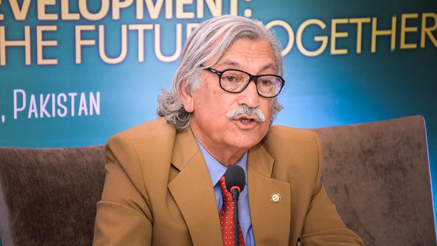
Being one of the most prominent geologists in Pakistan, Dr. Qasim Jan is a recognized international scientist and has received many awards, including TI, SI, HI, and honorary DSc degrees from King’s College London and the University of Leicester. He served as the Vice-Chancellor of the University of Peshawar, Quaid-i-Azam University, and Sarhad University. He has worked at several reputed national and international institutions and his impactful research focused on geology, mineralogy, geochemistry, and tectonics. He is currently serving as Distinguished National Professor (Emeritus) at the National Center of Excellence in Geology, University of Peshawar.
For our special edition on Natural Disasters, we caught up with Dr. Qasim to discuss climate change and how the past and present is responsible for it, disaster management, and the state of affairs in Pakistan, among other things.

Q. Geology is mainly the study of non-human-induced changes taking place throughout earth’s history. How could it better contribute to study climate changes?
Simply put, Geology is the study of the Earth, and climate changes are closely linked to the Earth. All the way from causes of climate change to consequences and mitigation require a sound knowledge of earth sciences. Many universities have now combined departments/ institutes for Earth and Environmental Sciences. The origin and survival of life are closely linked to water, and the study of water resources is an important branch of Earth Sciences.
So, the study of the environment cannot be isolated from the study of the earth. Environments are directly related to earth and so are geological sciences.
Q. A pre-industrial revolution record shows a significant increase in global temperatures. What do you think could be the best alternatives for coal, fossils, and other carbon-inducing agents?
The present Global Warming has been taking place for some 80-100 years, but particularly so over the past 50 years, with a temperature rise of 0.8 to 1.0oC. The projected increase is scary. A temperature rise of 2oC would be very harsh and 3oC would be a global disaster. There are a number of mitigation measures that need to be practiced. But, perhaps, the use of fossil fuels needs to be replaced very quickly by clean energy (such as solar, hydro, wind, hot springs, nuclear, etc.)
Forestry and plantation on the earth’s surface would also be helpful in reducing the harsh impact. There are some artificial practices like the management of solar radiation, but they are still under study. The utmost need at the moment is to produce an immediate substitute for hydrocarbons/ fossil fuels which are responsible for the greenhouse gases which are now commonly considered as the main reason for global warming. The current CO2 content at 419 ppm is double that of the pre-industrial time.
Q. How have natural causes affected climate change in the past ?
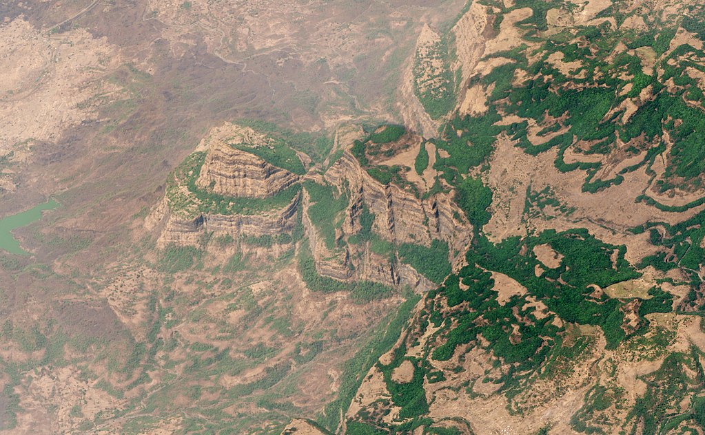
There have been long to short duration natural changes in the climatic conditions in the past which have resulted in the disappearance of species, the most popular of which are the dinosaurs. The dinosaurs disappeared at the end of the Cretaceous geological period, approximately 65 million years ago. Some speculate that there might have been metabolic changes, but the more popular theory argues that it happened because of climate change which was related to the impact of a 10 km-across asteroid in the Yucatan Peninsula in Mexico and /or extensive Deccan (India) volcanism.
Incidentally, the Deccan volcanism was one of the largest volcanic eruptions stretching up to southern Pakistan. The extensive volcanic outpouring in a span of two to four million years must have been accompanied by huge quantities of gases and dust which would have blanketed the earth for such a long time that some of the species had to die. A large asteroid impact could also have produced a large amount of dust, leading to the greenhouse effect.
In North Atlantic, about 55 million years ago, there was another huge volcanism that resulted in 100,000 years of a global warming period. Magma rose quickly to the surface and heated organic material, releasing methane and carbon dioxide which is resulted in blanketing and global warming.
Apart from the impact of asteroids/meteorites and volcanism, other possible natural causes of climate change include solar flares, cosmic radiation, changes in earth rotational orbit, low-level clouds, floods, storms, the decline in carbon sink, and wildfires.

Q. What about the linkage between variations in climate and human activities?
I do believe that present-day warming, and consequential climate change, are anthropogenic. As a matter of fact, there is a good correlation between temperature rise and carbon dioxide increase in the atmosphere. The large quantity of carbon dioxide and other greenhouse gases (such as methane, nitrous oxide, and fluorinated gases) in the atmosphere owe their origin to burning of the fossil fuels in industry, transport, agriculture, and buildings. Carbon dioxide, the principal greenhouse gas, takes flabbergasting one hundred years for its removal, and it has increased significantly over the past century to 419 ppm of the atmosphere (ca. in terms of sheer weight amounts to 40 billion tons). This is the highest concentration in the last four million years and twice the amount of pre-industrial time.
But climate change should not be viewed as an entirely warming phenomenon. Other human activities engaged in changing the landscape and cutting of forests, wastage and pollution of water and air, disrupting the ecosystem and habitat also pose serious threats to plant and animal life.
Q. The earth has been experiencing overwhelming natural disasters for the past few decades. How could modern technologies like GIS (Geographic Information Systems) and remote sensing help better understand natural disasters?
It is not correct to say that the natural disasters have been taking place over the last few decades. Major natural disasters have been occurring throughout human history, indeed geological history.
It is possible there has been an increase in the frequency of natural disasters over the past 50 years, but it can also be that because of faded memory and poor record-keeping we might be giving more importance to recent disasters which are fresh in the memory.
To illustrate, there were big floods in China in 1931 and 1887, and obviously, during that time we didn’t have the problem of present-day global warming. Those approximately killed 1-4 million and 1-2 million people, respectively. Going back further, China Shaanxi Earthquake in 1556 killed 0.83 million people and the Tangshan earthquake in 1976 killed 300,000 to 700,000 people.
The 2004 Sumatra tsunami in the Indian Ocean killed 200,000 people, but there was also the Italian Tsunami of 1908 that killed 123,000 people. As you can see, disasters have always been there, but whether their frequency increased in recent years is to be statistically confirmed.
I certainly agree that the use of GIS, Remote sensing, Early Warning Systems, and other technological tools and advances would be much helpful in the prediction and mitigation of natural disasters. In general, there is a fear that global warming and climate change are going to result in unpredictable weather, especially in superficial phenomena. To fight that, we need global collaboration because some of these events might be beyond the capacity of just one nation.
Q. Pakistan has been a frequent victim of earthquakes and other calamities. Why are we always underprepared in disaster management, when countries in similar geological states like Japan, are able to rebound so quickly?
It is a little too much to compare ourselves with Japan. Japan has a very old culture of science and technology and a very high level of education. Their financial resources and capabilities far exceed those of developing countries.
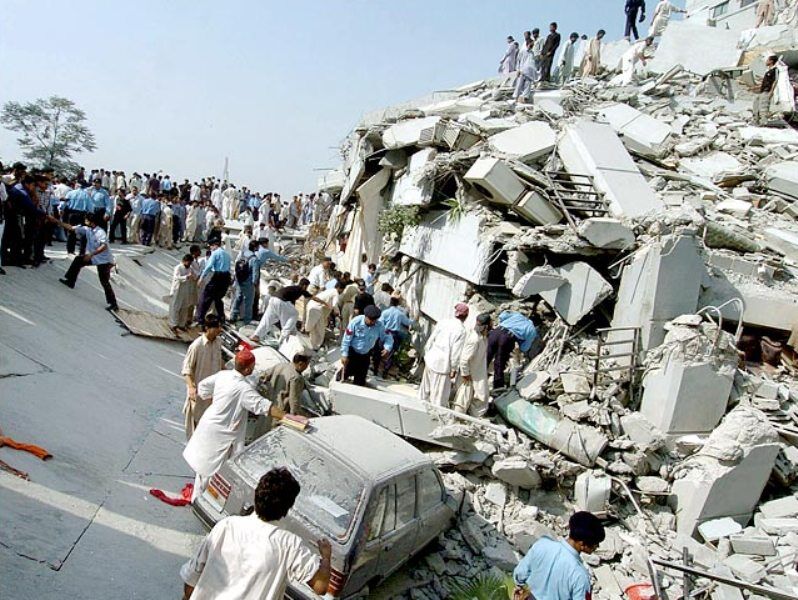
I agree that Pakistan is a seismically active zone and because of that natural disasters will keep on occurring. The 2005 Kashmir earthquake was very sudden. Even if we were prepared, we couldn’t have stopped the death of people from the jolt. And because earthquakes are not predictable, therefore you cannot evacuate towns in fear of a calamity that may not happen.

Similarly, if you look at the 2010 flood, Pakistan couldn’t have done much regarding that because it was too sudden (at least in the northern part of the country) and too big. Within a short span of time, there was this huge quantity of rainwater thrown down in Swat and adjacent areas of Hazara and Dir which ultimately aggravated into big floods in the South.
I personally think that since the earthquake in Kashmir, Pakistan’s level of disaster preparedness and mitigation certainly has improved. The government has established an agency for the purpose of national disaster management and with the passage of time, it will continue improving.
Q. Even though Pakistan has big deposits of natural resources, why haven’t we been able to do efficient resource management.
There is a common misconception in Pakistan that we are blessed with an abundance of resources. We have to get rid of this notion. Undoubtedly, Pakistan is not poor in terms of natural resources, but to say that it has a lot, is very rich is an exaggerated statement. But having said that, the country has large quantities of building materials and marble; some industrial minerals, evaporites (rock salt and gypsum), a couple of big copper deposits, and semi-precious stones. Apart from copper, we don’t have large deposits of metallic minerals, but we do have some reasonable deposits of industrial minerals.
The biggest natural resource of Pakistan is water, but with the passage of time, Pakistan has become a water strained country. We have one of the most widespread irrigation systems in the world, but we are wasting too much water because of obsolete irrigation methods and extreme water pollution.
We have not been able to benefit because our policies have been unrealistic, and our implementation has been even worse. One example is the Reko Diq project. The unnecessary entanglements and wrongdoings cost Pakistan pay billions of dollars. This shows the flaws in our policies. All international agreements need to be reached on the basis of good scientific information and sound legal advice.
Q. From Kalabagh to Diamer Basha, dam construction has always been a subject of much controversy in Pakistan. Can you share why there is so much debate when we are in dire need of controlling our resources?
The only national controversy has been the Kalabagh dam. The construction of the Kalabagh dam was affected by 1) interprovincial differences, and 2) obsession of a particular lobby in its support. The proposal was opposed by the smaller provinces, despite perhaps insufficient scientific evidence; only fear. If it is technically a safe site despite active tectonics and a layer of salt under the dam site, then there is no reason why the Kalabagh dam project should not go ahead, firmly guaranteeing, of course, a fair supply of water to the provinces of KP, Balochistan, and particularly Sindh. In a country with the inconsistent implementation of decisions, this will not be an easy task! But we must also keep in mind that there are other sites upstream on the Indus and other rivers for water storage and power generation and these need to be quickly pursued.
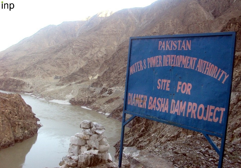
As far as the Diamer Basha dam is concerned, there isn’t a serious seismological danger. About 40 to 50 kilometers from the site of the dam there is an active fault that runs along the western margin of Nanga Parbat. Because of mass movement (sliding) along the fault, the Indus River was dammed near Rakhiot (now Raikot) in the 1850s, resulting in a big lake. Later it burst and the flood wiped out a whole Sikh regiment stationed at Attock near Indus-Kabul confluence. I am sure the engineers and builders of the Basha dam would take precautionary measures to avoid disaster in case of large landslide in the area.
I conclude that we need to construct water storages, but not at the cost of affecting national unity. But equally important, we are wasting a lot of water and polluting the remaining, which needs even bigger attention.

Q. There has been an establishment of Pak-China Earth sciences academic cooperation. What are your thoughts on that project?
Academic cooperation between Pakistan and China has been going on for quite some time and joint research is always good. The establishment of an earth sciences center in Islamabad will be impactful for three reasons. Firstly, it will improve our quality of education and research. Secondly, international researchers will have the opportunity to work in Pakistan with our scientists. This will be good for the promotion of science and global understanding through science diplomacy. Thirdly, the Center can play an important in the sustainability of CPEC. In the long run, a major goal of the CPEC is trade on land route between China and Pakistan.
Our land route, i.e., Karakoram Highway, passes through the tallest and rugged mountain ranges in the world (Himalaya, Karakoram, Hindu Kush, Kunlun) and is frequently blocked by mass movements, landslides and glacier surges, and glacial lake outbursts. It is essential to understand this region better through careful and detailed studies to ensure a smooth flow of trade along the KKH. As a matter of fact, this was also one of the primary reasons to establish this center.
Q. What contribution, do you think, your personal work has provided to the field?
Personally, I work for the love of discovering nature. As a human being, I believe I have a responsibility to understand the functioning of nature. The work we have done provides basic information about our hills and mountains. We have described rocks and minerals which are of interest to the economy and science of Pakistan. These include building materials (i.e., granites in Kohistan, Nagar Parkar, and Balochistan), chromites, gemstones, seismology, climate change, and natural hazards.
My research has not been primarily focused on minerals of economic importance, but it provided basic data for future activities on mineral exploration, engineering geology, etc. More importantly, our studies have contributed significantly to, and globally showcased, the crust building processes and geodynamics of northern Pakistan, Chagai-Raskoh arc, and Nagar Parkar. We (A.H. Kazmi & M. Q. Jan) also published a well-read seminal book on the “Geology and Tectonics of Pakistan” in 1997.
Q. How would you say the field of Geology/Earth Sciences has evolved with the advent of new technology over the years? And what is the status of geological research in Pakistan?
Geological sciences have indeed seen major advancements since the 1960s. First and foremost is the unifying theory of plate tectonics because of which we have started looking at the sectors of the earth from totally different and new perspectives. The earth sciences have become more multi-disciplinary and seen big advances in instrumentation. Thus, geology, in combination with space sciences and geophysics, have added much to surface mapping, subsurface structures, economic geology and petroleum exploration.
Pakistan also has progressed substantially in the earth sciences. At the time of independence, there were only a handful of geologists and few areas had been studied geologically. Today, there are over 20 departments and centers in the universities, and many organizations and companies which are involved in geological mapping, mineral exploration and exploitation, and oil and gas exploration. In this regard, the contributions of the Geological Survey of Pakistan (GSP) are highly admirable despite meager human, financial, and infrastructure resources. Some important earth sciences related finds include building material and decorative stones, industrial minerals, two big copper deposits, and oil and gas discoveries.
Geological research in Pakistan needs enhancement through induction of a larger number of well-qualified scientists and technical staff, well-equipped, properly maintained, and functional laboratories with sophisticated equipment, strengthening of the GSP, adequate support for fieldwork, and improvement of syllabi in the universities.
Q. What would be your advice to individuals interested in this field?
Success is fundamentally related to hard work, capacity building, a correct attitude, and working in close cooperation with colleagues. Ours is a field-dependent science and geologists should not lose focus on fieldwork. The world has become a global village and success requires passing through cut throat completion. Knowledge of developments in S&T and multi-national, multi-disciplinary, and multi-institutional collaboration is helpful for creativity and development of knowledge, sciences.
SAVE THE MOTHER EARTH AND ENJOY ITS BEAUTY!
Also Read: WORLD’S MOST DEVASTATING WILDFIRES AND THEIR IMPACT ON CLIMATE CHANGE

Maham Maqsood is a science communicator and co-founder at Scientia Pakistan. She is currently doing Masters in Biochemistry at the Middle East Technical University, Turkey. She has over five years of experience in science communication and outreach, collaborating with researchers, educators, and communicators to develop effective strategies and content for various platforms and events.

