
The collection of data from a distance by means of satellite or aircraft called remote sensing. Let’s dive into this exciting process and see what we have achieved until now and what we can hope to do in the future!
History of Remote Sensing
The term Remote Sensing was first used in the 1960s. The historical backdrop of Remote sensing starts with photography. During the American civil war, the photographs taken from air balloons were primarily used for military purposes. The beginning of different sorts of Remote sensing detection was started back in World War II. After the end of World War l, Aerial photography was being used for meteorological and agricultural purposes, and by the time it grew with the improvement of radar, sonar, and warm infrared location frameworks. Since the 1960s, sensors have been intended to work in essentially the entirety of the electromagnetic range. Today a wide assortment of far off detecting instruments are accessible for use in hydrological examines.
How it works?
Remote sensing devices have a sensor to collect data, sensors are mounted remote sensing devices, so they can collect reflected radiations from Earth. For example, airplanes, satellites.
There are two types of sensors: Active sensors and Passive sensors.
Active Sensors: Active sensors have their own source of energy i.e. they have such devices, which emit radiations to the particular area of examine.
Passive Sensors: The passive sensors depend on Sun for radiation emission.
Active sensor-based remote sensing work can be carried out at any time while Passive sensor-based remote sensing can only be carried out in the presence of bright daylight.

Pakistan in the field of Remote Sensing
The Pakistan Space and Upper Atmosphere Research Commission (SUPARCO) leads space research in Pakistan. Suparco’s projects comprise of the starting of sounding rockets and satellite applications, particularly far off detecting and interchanges. Its drawn-out objectives are to create interchanges and distant detecting satellites and to dispatch lightweight logical satellites in close Earth circles.
Pakistan’s Early Space Flights
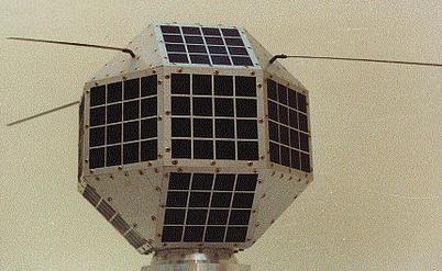
Badr 1:
It was one of the very first satellites of Pakistan that was launched in 1990 by SUPARCO. It was launched into a low Earth orbit through a Chinese rocket carrier.
This launch helped Pakistan in progressing in the field of military, technological, and scientific developments and also provided data on radio-signal distribution in the ionosphere (the upper most layer in space).
With the successful development and launch of the Badr-1, Pakistan became the first Muslim country and second South Asian country after India, to place a satellite in orbit. The satellite provided Pakistani scientists an academic, scientific, and amateur community experience in telemetry, tracking, and control and data communications as the satellite successfully completed store and dump message tests for 5 weeks.
This was the first and major step towards the development in the field of Remote sensing in Pakistan.
Badar-B:
After that, Badar-1 the satellite that has launched by Pakistan is Badar-B. The Badar-B was more advanced than Badar-l, with a CCD camera for pictures of Earth and a framework that permitted ground stations to alter the satellite’s position in space.
Satellites launched by Pakistan
Pakistan has almost five satellites in space. Pakistan Remote Sensing Satellite (PRSS-1) was the first dual-purpose, i.e. optical and earth observational, remote sensing satellite. It was launched by the collaboration of China from China’s Jiuquan Satellite Centreon 9th July 2018. One of the primary purposes of this satellite was to monitor progress as they build the China-Pakistan Economic Corridor.
Pakistan Technology Evaluation Satellite-1A (PakTES-1A), which was originally planned and created by Pakistan Space and Upper Atmosphere Research Commission (SUPARCO) engineers, has additionally been co-propelled with PRSS-1 by a similar vehicle.

These launches were held in china because Pakistan is still lacking in the field of launching.
Impacts of recently launched satellite
According to officials, it would help country in commercial satellites for collecting information related to:
- Meteorology.
- In better land management, and disaster management.
- Urban planning, mineral exploration.
- Crop yield forecasting, water management.
- Both civilian and military applications.
- One of the major Impacts can be seen in the position of Pakistan in the world space race.
- It also helps to spread general awareness for the study of Space Science
- Plus it flourishes Pak-China Friendship that leads to the development of Pakistan’s economy especially in the field of Education and Job.
Remote Sensing as a part of course curriculum in Pakistan
Two meetings of the National Curriculum Revision Committee (NCRC) for Remote Sensing (RS) & Geographical Information System (GIS) were held at HEC Regional center in Karachi (14-16th March 2005) and Lahore (16- 18th May 2005). Realizing the importance of RS & GIS in the developed world area as well as in developing countries such as India, these meetings were organized by the Higher Education Commission of Pakistan. The focus was given to develop international standard curricula and launch 4 years BS and 2 years MS degree programs for both public and private sector degree-awarding institutions and universities of Pakistan. Various Remote Sensing, GIS, Information Technology professionals, Geographers, and educationists from all over Pakistan attended these meetings.
Future of Pakistan in Space Science
Pakistan’s Federal Minister for Science and Technology, Fawad Chaudhry, unveiled some plans last year for the promotion and development of space science.
“Proud to announce that selection process for the first Pakistani to be sent to Space shall begin from Feb 2020, fifty people will be shortlisted — list will then come down to 25 and in 2022 we will send our first person to space,” Chaudhry said. This will be the biggest space event of our history, he added.
Chaudhry said the Pakistani Air Force will play a lead role in the selection process of the astronaut for the space mission.
“The Air force will be the custodian of the selection process. Globally pilots are selected for space missions,” he was quoted as saying by the Dawn News website. “Ten pilots will be trained and eventually one pilot will be sent to space,” he said.
Also Read: Pakistan’s first private company in space

Waniya Khursheed is a student of Space science at Karachi University, She is working as Event Manager at RaheQamar. She is working to promote space sciences in Pakistan. She hopes that one day Pakistan will play an active part in the Global Space industry.
